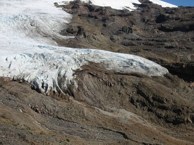
Gangotri glasier is located in Uttarkashi District, Uttarakhand, India in a region bordering China. This glacier, source of the Ganga, is one of the largest in the Himalayas with an estimated volume of over 27 cubic kilometers.[1] The glacier is about 30 kilometres long (19 miles) and 2 to 4 km (1 to 2 mi) wide. Around the glacier are the peaks of the Gangotri Group, including several peaks notable for extremely challenging climbing routes, such as Shivling, Thalay Sagar, Meru, and Bhagirathi III. It flows roughly northwest, originating in a cirque below Chaukhamba, the highest peak of the group.

The terminus of the Gangotri Glacier is said to resemble a cow‘s mouth, and the place is called Goumukh or Gaumukh (gou, cow + mukh, face). Goumukh, which is about 18 km (11 miles) from the town of Gangotri, is the precise source of the Bhagirathi river, an important tributary of the Ganga. Goumukh is situated near the base of Shivling; in between lies the Tapovan meadow.
The Gangotri glacier is a traditional Hindu pilgrimage site. Devout Hindus consider bathing in the icy waters near Gangotri town to be a holy ritual, and many make the trek to Goumukh and Tapovan.In recent times, it has been pointed out that the retreat of the glacier has quickened significantly.
It is a valley-type glacier, situated in the Uttarkashi district of Garhwal Himalaya, Uttaranchal (Figure 1) and it flows to NW direction. This glacier is bound between 30°43’22″–30°55’49″(lat.) and 79°4’41″–79°16’34″(long.), extending in height from 4120 to 7000 m.a.s.l. This area is situated north of the Main Central Thrust (MCT) and is made up of bedrocks of granites, garnet mica schist, quartz biotite schist, kyanite schist, augen gneiss and banded augen gneiss. [2] the glacier is composed of a variety of depositional features such as talus cones, snow-avalanche fans, snow-bridges, and dead ice mounds, and erosional features like pyramidal and conical peaks, serrated ridge crests, glacial troughs, smooth rock walls, crags and tails, waterfalls, rock basins, gullies and glacial lakes. All along the Gangotri glacier, several longitudinal and transverse crevasses are formed along which ice blocks have broken down. The ablation zone of the Gangotri glacier is covered by a thick pile of supraglacial moraines and is characterized by several ice sections, melting into pools of supraglacial lakes. Because of subsidence and the fast degenerating nature of the glacier, its centre is full of supraglacial lakes. In this part of higher Himalaya, glacial melt-water dominates the fluvial system.

The total ice cover is approximately 200 km² and has about 20 km³ of ice in volume.

Gangotri glasier

Gangotri Glasier

Himalaya gangotri glasier

Tertimus glasier_at bhutan
A glacier terminus, or snout, is the end of a glacier at any given point in time. Although glaciers seem motionless to the observer, in reality glaciers are in endless motion and the glacier terminus is always either advancing or retreating. The location of the terminus is often directly related to glacier mass balance, which is based on the amount of snowfall which occurs in the accumulation zone of a glacier, as compared to the amount that is melted in the ablation zone. The position of a glacier terminus is also impacted by localized or regional temperature change over time.
sumber dari wikipedia dan di susun ke blog oleh
hazaldin topobarat.kuala lumpur.
Copyright okt 2009


You must be logged in to post a comment.